
Understanding a zoning code can be challenging and unintuitive, especially when the code itself is separate from the zoning map.
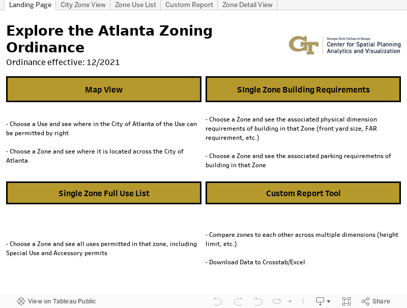
The ATL Zoning Code Explorer is a set of interactive dashboards that allow users to explore the land use implications of Atlanta’s zoning ordinance. Every type of zone has a list of uses, directly in the ordinance, that can receive permits either by right or conditionally. Each use has requirements to receive a permit, such as being set back a certain distance from the street or being limited to a certain height. Most, but not all, zones have requirements for a number of parking spaces to support this use. The views below allow users to see many of these requirements for zones across the city and create downloadable reports that cover multiple zones.
The ATL Zoning Code Explorer is a product of Georgia Institute of Technology’s Center for Spatial Planning Analytics and Visualization (CSPAV) . It was created by Mark Schwabacher in Spring 2022.
The data for these visualizations is from the December 2021 update to the City of Atlanta’s Code of Ordinances Future updates to the zoning code will supersede the requirements available here. Geographical zoning data is courtesy of the City of Atlanta and the Atlanta Regional Commission data portal. For additional detail on permitting requirements, please refer to the City of Atlanta permitting portal.