
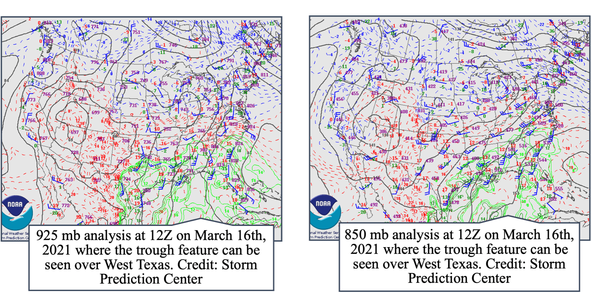
On March 15th the National Weather Service put out a convective outlook for the next day with a prediction for a slight risk of convective activity over Kansas, Oklahoma, and a part of Texas and marginal risk and risk of thunderstorms as far North as Iowa and as far East as the Carolinas. Those risks manifested in wind, hail reports, and tornadoes. The system that was the source of these intense thunderstorms was an extratropical cyclone that was supported by a low-level jet stream. Focusing on the 925 and 850 millibar levels at 12Z on March 16th, there was a clear trough feature that was situated over Texas and several other Great Plane states. The trough feature can be directly correlated to this initial round of intense thunderstorms and supercells, due to the fact that rising motion forces air into the tropopause can lead to strong updrafts and thus strong thunderstorms near the troughs. This can lead to increased convective activity and an increased chance of intense precipitation and convective activity.
On the 16th of March, another convective outlook was produced by the Storm Prediction Center with not only enhanced and moderate risks for severe thunderstorms but also an area of high risk over Alabama, Mississippi, and parts of Louisiana and Missouri. The reason that a high convective outlook is so significant is because they are so seldom issued. As a matter of fact, the high convective outlook issued on the 16th of March, was the first one issued since 2020. By the 17th, the trough feature had deepened and the low-level jet at both the 850 and 925 millibar levels had strengthened. This allowed for not only shear, with the increasing wind speed and change in direction with height, but also allowed for the acceleration of the movement of any supercells that formed. Additionally, when examining the Skew-Ts many of the aspects of instability that are necessary for severe thunderstorms were present in the atmosphere: shear, CAPE, lift, and thermodynamic instability. Some of these elements are not evident in the Birmingham sounding at 18Z, but the some of the other elements on the sounding, such as the Bulk Richardson Number for shear was 123 m^2/s^2, a value indicative of high potential for supercell thunderstorms and intense thunderstorms.

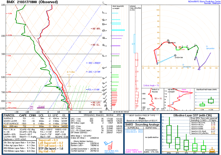 Birmingham, Alabama sounding at 18Z on March 17th, 2021
On the 16th of March, according to the Storm Prediction Center, there were three tornado reports, the strongest one reported being EF1, 48 wind repots, and 55 hail reports. On the next day, there was a great amount of suspense waiting for the first warnings and watches the first being issued at 1243 UTC in Northwestern Mississippi. The 17th of March had 56 tornado reports, the strongest being an EF2, a total of five injuries, 102 wind reports, and 49 hail reports. This was a destructive storm system that has the potential to cause damage and did. The subsequent days of this extratropical cyclone also brought damage and destruction to areas on the East Coast.