
![]()
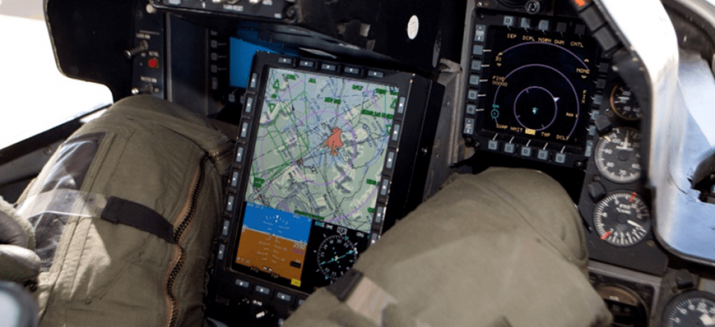
FalconView® is a Windows-based mapping system developed by the Georgia Tech Research Institute (GTRI) for the Department of Defense. Initially released for the U.S. Air National Guard (ANG) in 1994, FalconView’s sponsor and user base quickly expanded to include all branches of the U.S. military. Today, it’s used by the military, various federal agencies and allied countries for a variety of mission planning, intelligence, and operational tasks. It serves as the mapping interface for various mission planning software suites including the Joint Mission Planning System (JMPS), Portable Flight Planning Software (PFPS), and XPlan. Among users the graphical view of these tools is commonly known as FalconView.
|
|
|
|
|
 data provided by NGA")


FalconView displays various types of maps including aeronautical charts, satellite imagery, and elevation maps. It also supports a large number of geographically referenced overlays that can be displayed and printed over any map background. The current overlay set is targeted toward military mission planning, rehearsal and execution, with a focus on aviation. Most of the source data displayed by FalconView is produced and distributed by the National Geospatial-Intelligence Agency (NGA).
|
|
|
|


Combined with a global positioning system (GPS) receiver, FalconView serves as a navigation system on several airborne, land, and sea platforms; providing real time situational awareness in transit. It was in this capacity that FalconView was used onboard Air Force One in the late 1990’s.
While our primary target platform has been Windows, GTRI has supported FalconView on other platforms. In more recent years FalconView added Web-support as both a consumer and provider of content. For example, FalconView displays Web Map Service (WMS) data. In addition, GTRI used FalconView to implement both Web Map Tile Service (WMTS) and WMS to provide traditionally supported geospatial data types (CADRG, ECRG, MrSID, DAFIF) for use in web applications. The FalconView team is currently researching the decomposition of capabilities into microservices to support the next generation of mission planning systems.