In the coming decades the state of Georgia will face larger and larger challenges due to climate change. With continuing business-as-usual greenhouse gas emissions, by 2100 the average temperature across the state will increase by over 7 degrees Fahrenheit. Even with reduced emissions the average temperature across the state will still increase by 3 degrees Fahrenheit. Georgia’s changing climate will result in increased mortality, agricultural losses, damage from coastal storms, and crime rates. It will also produce more severe storms, lengthier droughts and greater volatility between periods of high and low temperatures and high and low precipitation.
Until the recent past, Georgia’s policymakers, planners, and citizens have relied on the historical climate as a reliable indicator of our future climate. But due to climate change our future climate will be substantially different from our past (or current) climate.

The purpose of this website is to use geographic information system (GIS) technology to gather, analyze, and publish a wide variety of reliable, well-documented, statewide, climate-change-related spatial information. This collection will provide a common framework for researchers, decision-makers, and citizens to come to grips with our changing climate and begin to take appropriate action.
Because Georgia is a large state, the effects of climate change and the possibilities for mitigation policies and adaptation actions vary widely across the state. The availability of spatial GIS data will allow the state’s many cities, counties, and regions to craft policies specific to the circumstances of their individual areas.
There is an abundance of U.S. and international data available related to climate change. We have identified several of the most important climate change areas and developed initial statewide datasets for each of those areas. The page(s) for each area explain the background and sources for the datasets, show preview interactive maps, and provide download links to the datasets themselves.
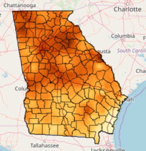
 Georgia’s changing climate: 2020 to 2100
Interactive maps and data for projected statewide average temperature and annual precipitation from present to 2100. Also includes 46 additional variables related to drought, severe storms, and other climate-related areas. The full variable list is available here.
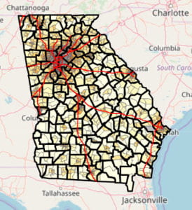
 Georgia future land use: 2020-2100
Interactive maps and data for Georgia projected future land use from present to 2100. Includes projections every 10 years for two shared socioeconomic pathways: SSP2 and SSP5.
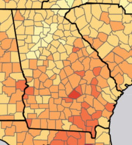
 National projected costs and damages due to climate change for end of 21st century
Interactive maps and data for projected end of 21st century damages due to climate change in seven areas, plus total damages as percent of county income. Data is from the 2017 Science article by Solomon Hsiang and 11 co-authors.
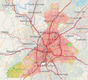
 Neighborhood-level estimated energy CO2 emissions for 2016
Interactive maps and data for estimated 2016 energy CO2 emissions at the census tract level. Data and maps have estimates for residential, commercial, industrial, and transportation sectors, plus total energy emissions.
 Projected sea level rise from present to 2200
Interactive maps and data for multiple global mean sea level rise scenarios, and zipped shapefile of spatial sea level rise data for entire U.S.

