
Origins of the Project
We launched this research project with the aim of understanding the potential of megaregions as platforms for fostering sustainable development. Our initial interest was in seeking lessons through the comparative analysis of three “established” megaregions — the Boston-Washington corridor, Greater Tokyo, and the Amsterdam-Brussells-Antwerp triangle. However, it soon became clear that a broadly accepted definition of “megaregion” does not exist, making it difficult to differentiate a megaregion from a “metropolitan area” or “urban corridor.” This led us to conduct a systematic review of the scholarly and practitioner literature, from which we distilled three dominant approaches.
Three Dominant Approaches
After reviewing the top 600+ megaregion-related papers identified through a search of Web of Science and Google Scholar, we identified three dominant approaches.
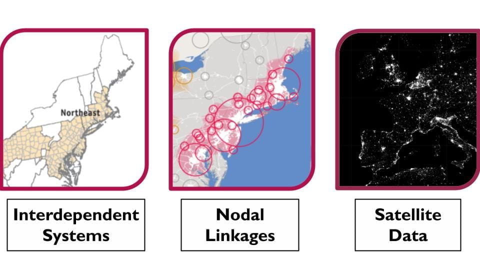
The “interdependent systems” approach emphasizes the interconnectedness of megaregions as reflected in convergence, collaboration, and shared economic, infrastructural, environmental, and cultural ties. The “nodal linkages” approach focuses on key nodes that are identified and linked primarily by infrastructural connections. And the “satellite data” approach uses night light emissions data to precisely map megaregion boundaries. We came to believe that each approach offers distinctive strengths and weaknesses, suggesting that a consistent, layered system of delineation might provide a productive methodology for analyzing megaregions.
Takeaways
From this we came to understand that a combined approach to megaregion delineation can exploit the respective strengths of all three approaches. We are confident that a layered approach — starting off using satellite imagery to set a precise boundary, then identifying and tracing nodal linkages, and, finally, assessing aspects of interconnectedness — offers a fruitful path forward in understanding the reality and potential of megaregions.