
On Wednesday, March 24th, 2021, a low-pressure system moved across the Southwestern United States dropping much needed precipitation in the forms of both rain and snow in the area. As seen in the visible satellite image in Figure 1, the low-pressure system targeted New Mexico and the Four Corners region of the United States. In this image, you can see that the low-pressure system in question does not exactly have the defined comma shape of a typical extra-tropical cyclone, especially in comparison to the stronger low-pressure system that curls up the east coast and up around the Great Lakes region. The reason for the lack of this typical shape could be due to a couple different reasons including the weak nature of this system or the current location of the system being far from an oceanic source of moisture. Although it was not the strongest system, the precipitation it brought was incredibly important due to the severe drought that this region is experiencing, especially moving into the warmer seasons of spring and summer.
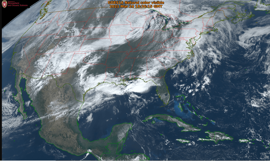 Figure 1: Visible Satellite Imagery (UW Madison) at 18Z on March 24th, 2021 showing the low- pressure system sitting over New Mexico and the Four Corners region.
To further analyze the strength and moisture associated with the system, we can look to the water vapor satellite imagery shown in Figure 2. Looking at the Southwestern U.S., you can clearly see the bright white and light gray signatures associated with high to moderate moisture content in the clouds. These colors clearly show the presence of a system that is expected to bring some precipitation to the area. Another notable feature on this image, is the dry streak that dips southward and then curves northward around the low. The clear color gradient between the dry, black air and the moist, light air reveals that this is the location of the jet stream, and more specifically a trough supporting this surface low. It is also interesting to note the large dark streak cutting through the southeast in between the two low-pressure systems, creating a moist, dry, moist pattern across the continental United States.
 Figure 2: Water Vapor Satellite Imagery (UW Madison) 18Z March 24th, 2021 showing the moisture levels associated with the low over the Southwestern United States.
To decipher the intensity and type of precipitation expected from this system, we can look at the radar image shown in Figure 3. In this image, you can see a clear patch of blue and green reflectivity centered over New Mexico and Texas. Cooler colors, such as green and blue, are associated with less intense precipitation than the warmer colors, such as yellow and orange, indicating that this low-pressure system is associated with lower intensity precipitation. To help determine which type of precipitation is falling, you can look at whether the signature appears smoother in nature or rougher/defined. As seen around the northern edge of the storm, the smoothness indicates that the precipitation dropped in this area is in the form of snow. However, more towards the south of the storm, there are pockets of yellow more defined signatures that represent higher intensity rain precipitation. However, not every signature on a radar reflectivity map indicates precipitation. The sporadic blue spots you notice on the image are called false echoes and are a result of reflection off of a building, landform, or other large object.
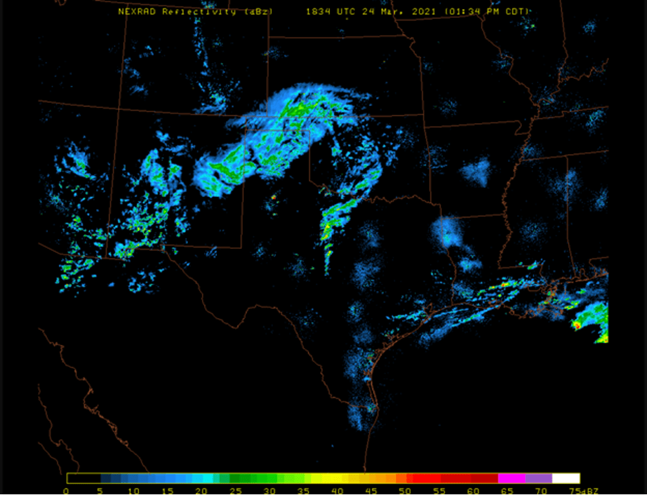 Figure 3: NEXRAD Radar Reflectivity Image (UW Madison) at 18Z on March 24th, 2021 showing reflectivity values for the system over the southwest.
Finally, we can look at Figure 4 to dive into the human impacts of this extra-tropical cyclone, both positive and negative. The image on the left shows the current hazard warnings issued by the National Weather Surface around 18Z on March 24th while the image on the right shows the individual reports of precipitation, winds, and property damage. There is a clear conglomeration of both warnings and reports centered over New Mexico where the low-pressure system dropped most of its precipitation. On the left, the purple regions represent winter weather advisories while the pink regions represent winter storm warnings. It is also interesting to note the thin region with no warnings through the center of the state which was most likely unaffected due to lower altitudes. On the right, the gray symbols represent observed snow, the green represent observed rain, and the blue and red representing high winds and wind damage respectively. These reports correlate well with the data we observed on radar of both snow and rain precipitation in the region. Across the state, the snow ranged from 0.2 inches to 6.5 inches at 18Z, and the wind gusts ranged from 55-65 miles per hour proving that even a weaker low-pressure system can bring serious impacts.
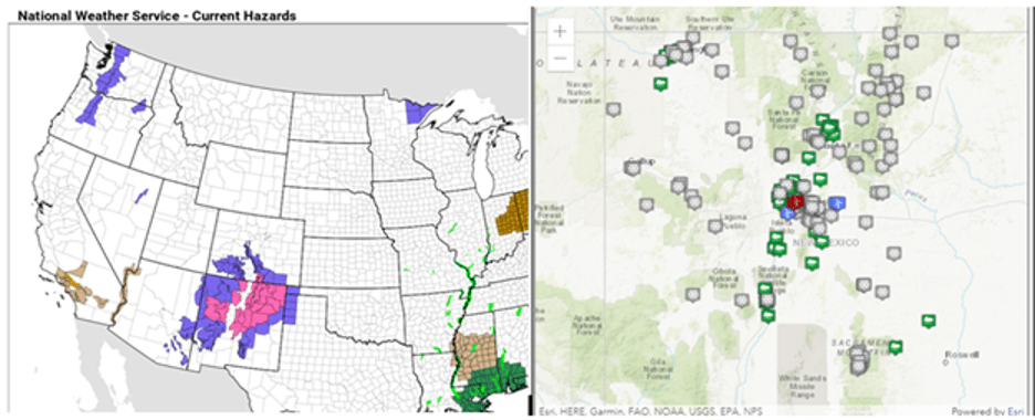 Figure 4: Current Hazards and Observation Reports (National Weather Service) at 18Z March 24th, 2021.
Even though it appeared late in the winter storm season, this low-pressure system was impactful to the Southwestern United States as it brought much needed precipitation to the dry Four Corners region. The final totals of snowfall in New Mexico ranged from 6 to 16 inches in some of the higher altitudes, providing some drought relief for the region as the dry summer months approach. After moving through the southwest, this low dissipated and moved eastward across the United States continuing to drop minimal precipitation in the form of rainfall.