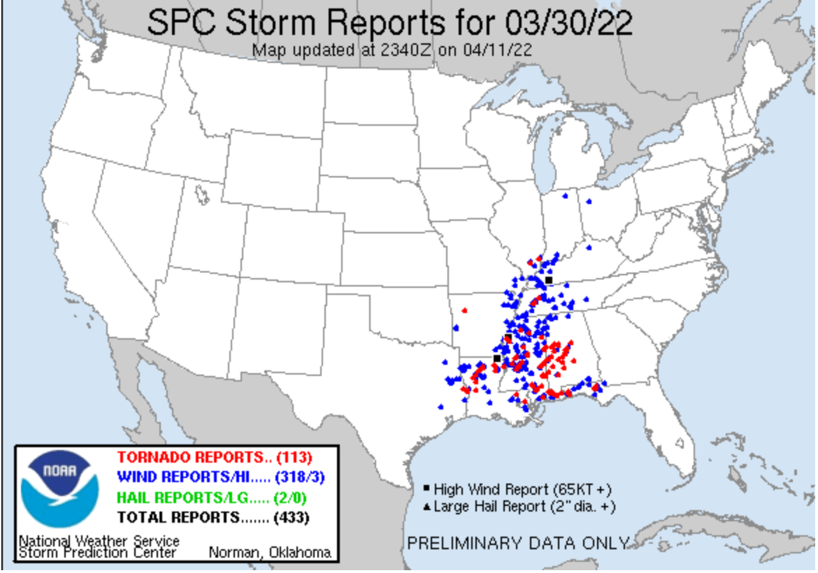
March 30 – 31, 2022, multiple states in the southeast region experienced severe weather roll through due to a squall line. Over 8 states including Louisiana, Mississippi, and Alabama were under tornado watch. Figure 1 shows the SPC Storm Reports show the total wind and tornado reports from March 30, 2022. The amount of high wind speed reports demonstrate the severity of the storm that rolled through. It also led to 113 tornadoes reported that caused damage as the squall line moved east.

Figure 1: SPC Storm Reports map for March 30, 2022 where the blue dots represent high wind reports and the red dots represent tornado reports extending over the southeast region.
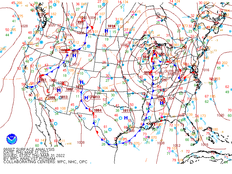
The squall line that moved across the south causing the severe wind speeds and tornadoes was a result of a squall line that developed in front of an extensive cold front. The cold front extended from Indiana south through Louisiana at 06Z March 31, 2022 is seen in Figure 2a. The severe storms form ahead of a cold front because wind shear combined with unusually widespread lifting of the lower atmosphere causes convection to become arranged in a banded structure. Figure 2b shows a good depiction of the squall line over the south at the same time, 06Z March 31, 2022 when the high level clouds where the convection is occurring is shown in white on the Airmass RGB. As the storm moves east smaller portions of the high clouds break off over southern Louisiana and Mississippi and the severity of the storms in these isolated areas increase.


Figure 2: a. WPC surface analysis map at 06Z March 31, 2022 showing an extensive cold front across the southeast. B. Airmass RGB map from 06Z March 31, 2022 showing thick, high level clouds in white
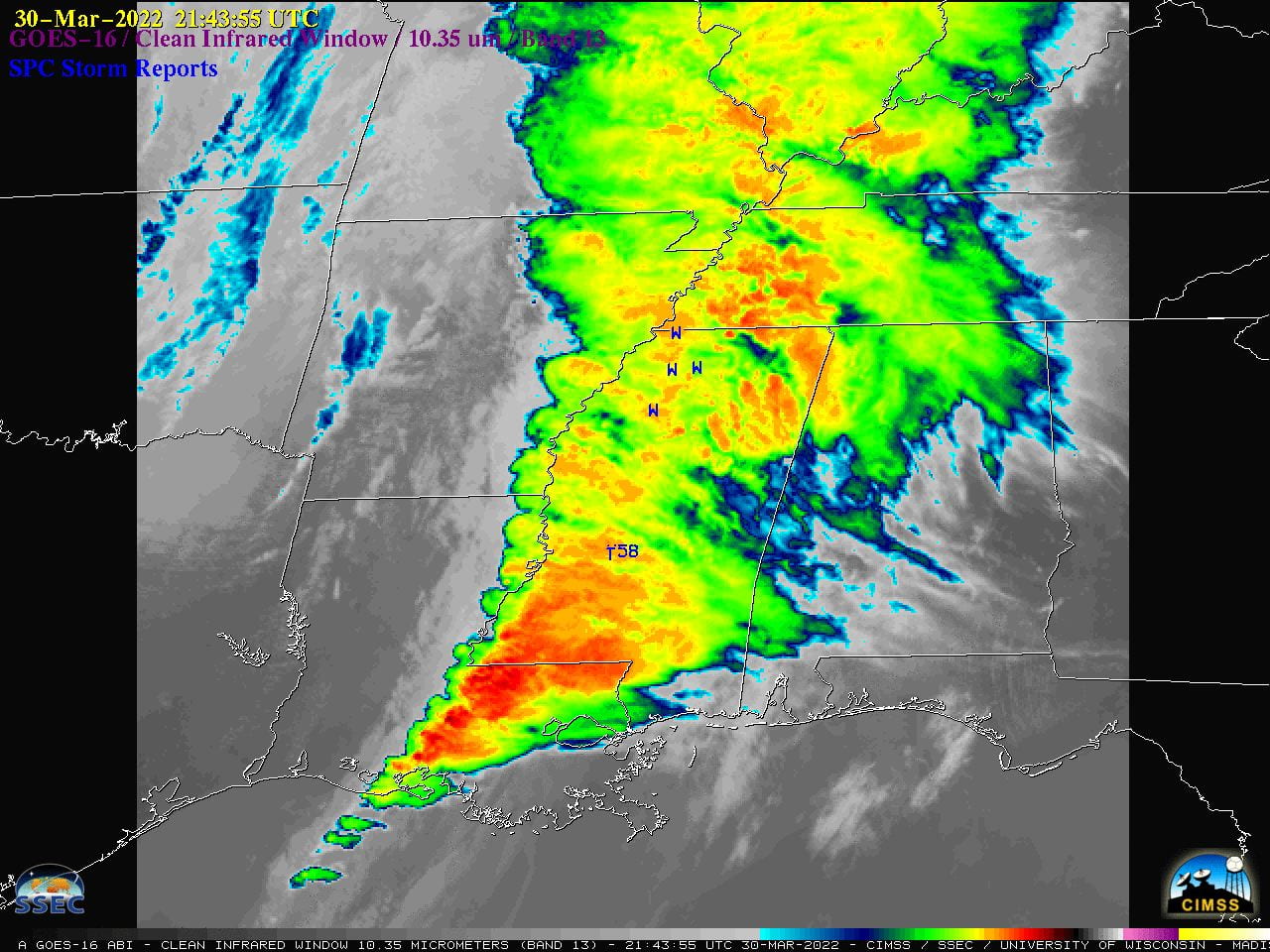
The banded structure caused the highest wind speeds and tornadoes the evening of March 30, 2022. The area in red in Figure 3 shows the areas of highest severity and precipitation. The night of March 30, 2022 tornadoes tore across Louisiana, Mississippi and Alabama resulting in two people being killed and extensive damage. There was also and EF-3 tornado with winds up to 145 mph that tore through Springdale, Arkansas, on March 29, injuring seven people and inflicting heavy damage to an elementary school at the beginning of this severe convection.

Figure 3: Radar reflectivity map at 21Z March 30, 2022 of the squall line and isolated thunderstorms that produced tornadoes and high speed winds.
The damage mostly came from the tornadoes that resulted from the squall line that occurred ahead of the cold front. The tornadoes were able to be measured using the Significant Tornado Parameter (STP) which is a multiple component index that is meant to highlight the co-existence of ingredients favoring right-moving supercells capable of producing F2 – F5 tornadoes. Some ingredients used to determine STP include 0-1 km storm relative helicity and CAPE. Figure 4 shows a map of the STP values at 21Z March 30, 2022 when the storm was intensifying into the morning of March 31, 2022. This point of the storm is when the severe weather including the high winds and tornadoes really began to affect the south before eventually dissipating many hours later.

Figure 4: Map of the significant tornado parameter(STP) values for 21Z March 30, 2022

