
Early into the pandemic in the United States, a major tornado outbreak occurred in the southeast. To set the stage for this event, prior to April 12th and 13th, an elongated region of low pressure moved across the United States. This low-pressure area, called a trough, had a fast jet stream to its east in the mid-levels of the atmosphere. Farther down in the atmosphere, the air was not moving quite as swiftly. This difference in wind speed with height is called speed shear and is conducive for tornadic development. Below are two depictions of the upper tropospheric wind speeds on the left and the mid to lower tropospheric wind speeds on the right. The red-to-white colors indicate faster wind speeds.
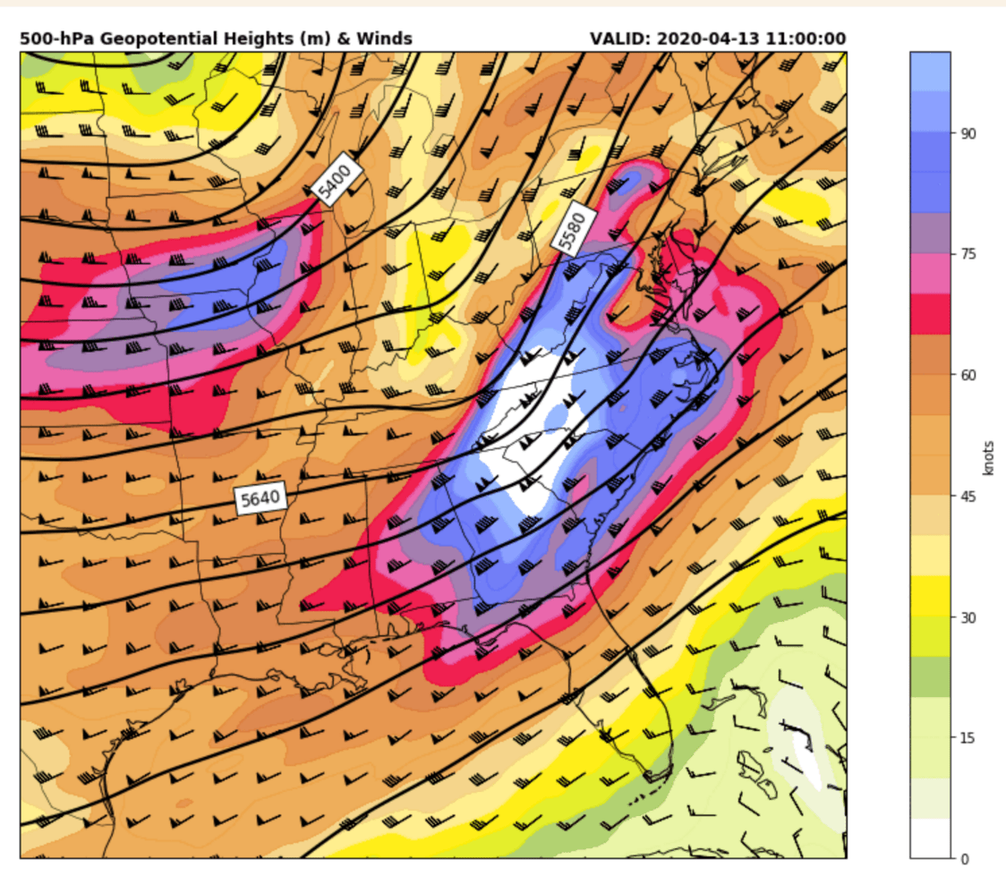
Figure 1. Wind speeds and geopotential heights at the 500 millibar level in the troposphere at 11:00 UTC on April 13, 2020.

Figure 2. Wind speeds and geopotential heights at the 850 millibar level in the troposphere at 11:00 UTC on April 13, 2020.
These factors, coupled with abnormally warm Gulf of Mexico water temperatures, allowed for a dangerous and highly active storm event. Over 36 tornadoes were recorded in South Carolina alone, with 9 total deaths. One area of interest is the Central Savannah River Area (CSRA), which saw 5 EF-3 tornadoes, including one that killed two people. A doppler radar located near Columbia, SC saw several of these tornadoes. Below is a depiction of several radar images that show the tornadoes. The tornadoes may be differentiated from rain by noting the bluer colors in the bottom right image. This radar product allows for differentiating types of precipitation and can also indicate debris picked up by tornadoes. The debris shows up as blue here.
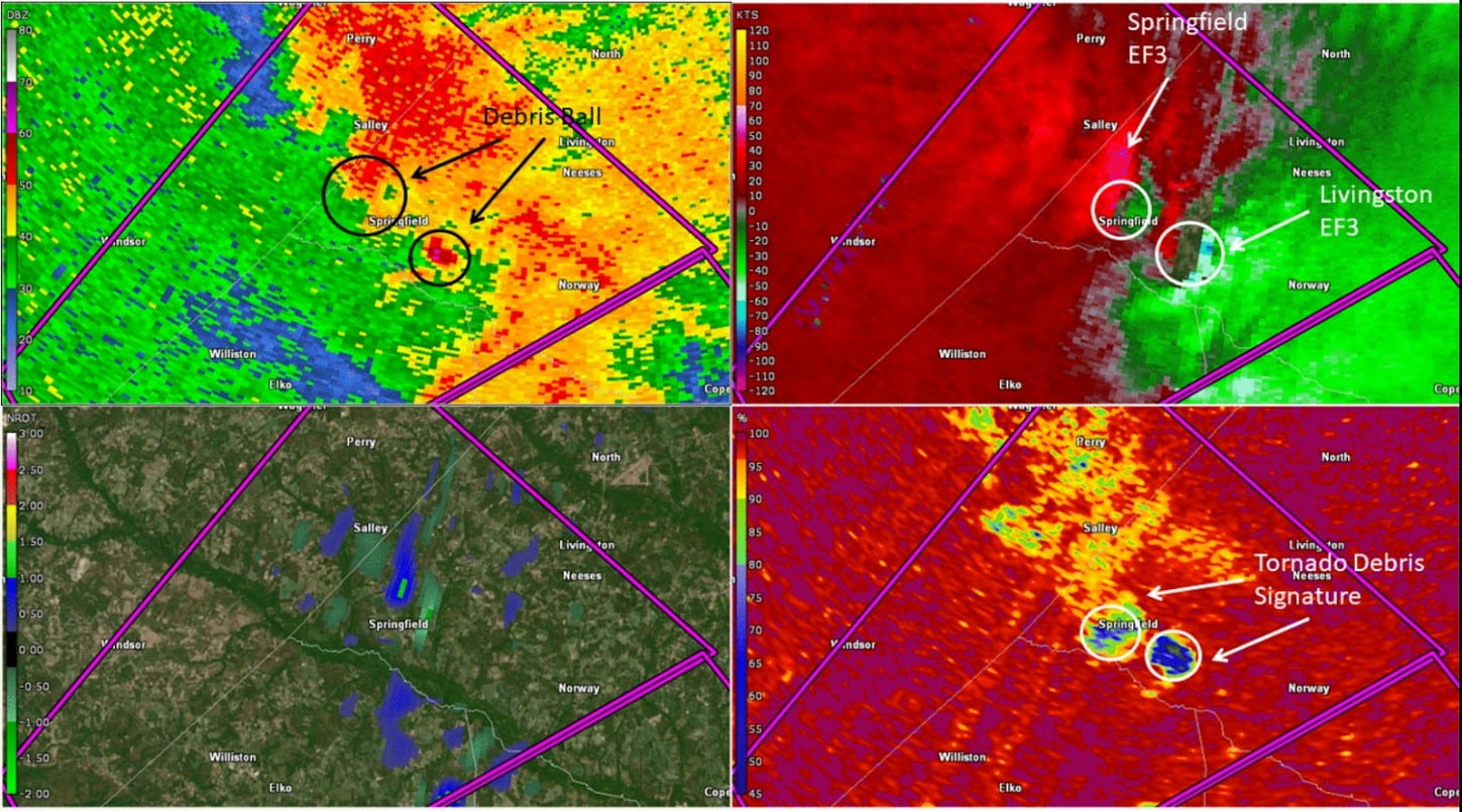
Figure 3. Radar images showing two EF-3 tornadoes during the outbreak. The products shown are: Top left: Base Reflectivity Top right: Relative Velocity Bottom Left: Normalized Rotation Bottom Right: Correlation Coefficient
These tornadoes occurred at roughly the same time, causing a path of destruction in their wake. Extending across three counties, both the Springfield and Livingston tornadoes brought with them 135 mph+ winds, with widths of up to 800 yards. By traveling to these areas after the destruction and observing the damage along with observing radar data such as in Figure 3, meteorologists can obtain the track of the tornadoes. In Figure 4, the track of several strong tornadoes is shown across the CSRA.
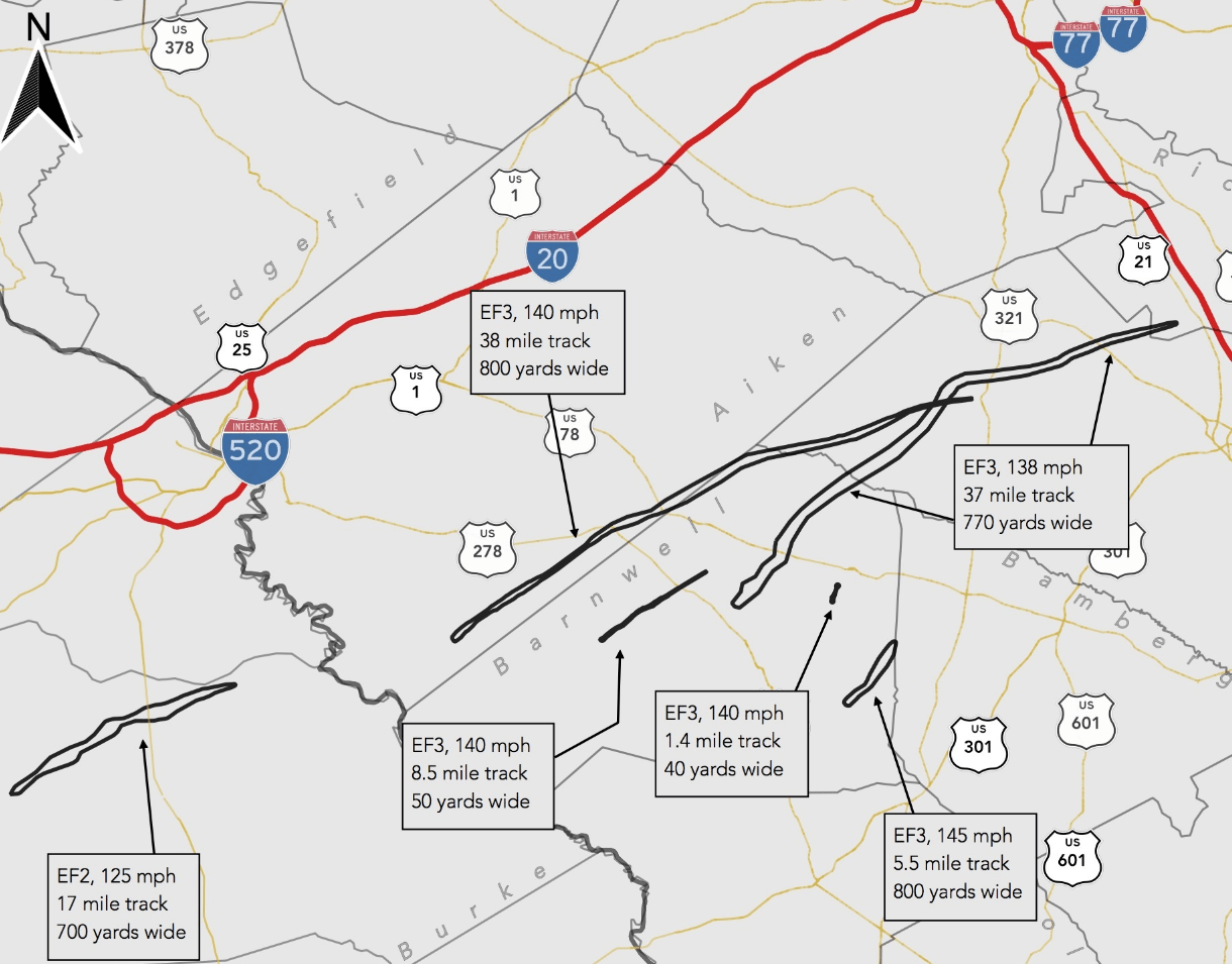
Figure 4. Strong tornado tracks across the CSRA on 13 April 2020.
In some cases, the track of the tornado may be seen in satellite imagery thanks to comparing photographs before and after the event. One satellite, which has an image mode that is designed for imaging vegetation growth and development, was able to do this. In Figure 5, the destruction of trees and other vegetation is apparent as a black color. Using imagery like this can allow meteorologists to better understand how these tornadoes evolved and developed and provides insight into their behavior.
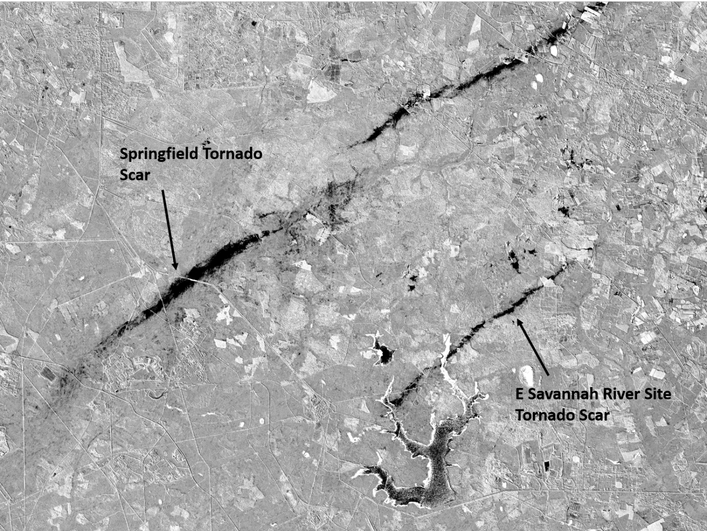
Figure 5. Imagery that shows how the two EF-3 tornadoes destroyed trees and vegetation.